Homes, condos and land for sale and rent in Oxnard, CA
Oxnard was incorporated in 1903. It is located at the western edge of the fertile Oxnard Plain, sitting adjacent to an agricultural center of strawberries and lima beans. Oxnard is also a major transportation hub in Southern California, with Amtrak, Union Pacific, Metrolink, Greyhound, and Intercalifornia stopping in Oxnard. Oxnard also has a small regional airport called Oxnard Airport (OXR). Oxnard is also the location of the National Weather Service forecast office that serves the Los Angeles area.
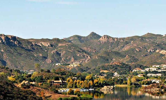
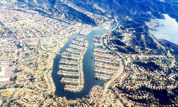
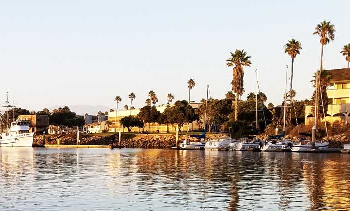
In the mid-20th century Oxnard grew and developed the areas outside the downtown with homes, industry, retail, and a new harbor named Channel Islands Harbor. Martin V. (“Bud”) Smith (1916–2001) became the most influential developer in the history of Oxnard during this time. Smith’s first enterprise in 1941 was the Colonial House Restaurant (demolished 1988) and then the Wagon Wheel Junction in 1947, (demolished 2011). He was also involved in the development of the high-rise towers at the Topa Financial Plaza, the Channel Islands Harbor, Casa Sirena Resort, the Esplanade Shopping Mall, Fisherman’s Wharf, the Carriage Square Shopping Center, the Maritime Museum, and many other major hotel, restaurant and retail projects.
Beaches in Oxnard include: Ormond Beach, Silver Strand Beach, Hollywood Beach, Hollywood-By-the-Sea, Mandalay Beach, Oxnard Beach Park, Oxnard Shores, 5th Street Beach, Mandalay State Beach, McGrath State Beach and Rivermouth Beach.
The Census reported that 196,465 people (99.3% of the population) lived in households, 932 (0.5%) lived in non-institutionalized group quarters, and 502 (0.3%) were institutionalized.
There were 49,797 households, out of which 25,794 (51.8%) had children under the age of 18 living in them, 28,319 (56.9%) were opposite-sex married couples living together, 7,634 (15.3%) had a female householder with no husband present, 4,043 (8.1%) had a male householder with no wife present. There were 3,316 (6.7%) unmarried opposite-sex partnerships, and 395 (0.8%) same-sex married couples or partnerships. 7,090 households (14.2%) were made up of individuals and 2,665 (5.4%) had someone living alone who was 65 years of age or older. The average household size was 3.95. There were 39,996 families (80.3% of all households); the average family size was 4.20.
The population was spread out with 59,018 people (29.8%) under the age of 18, 23,913 people (12.1%) aged 18 to 24, 57,966 people (29.3%) aged 25 to 44, 40,584 people (20.5%) aged 45 to 64, and 16,418 people (8.3%) who were 65 years of age or older. The median age was 29.9 years. For every 100 females there were 103.0 males. For every 100 females age 18 and over, there were 102.4 males.
There were 52,772 housing units at an average density of 1,962 per square mile (757.6/km²), of which 27,760 (55.7%) were owner-occupied, and 22,037 (44.3%) were occupied by renters. The homeowner vacancy rate was 1.8%; the rental vacancy rate was 3.7%. 107,482 people (54.3% of the population) lived in owner-occupied housing units and 88,983 people (45.0%) lived in rental housing units.
Other cities in Ventura county
Thousand Oaks Real estate for sale and rent
Homes, condos and land for sale and rent in Thousand Oaks, CA Thousand Oaks is a city in southeastern Ventura County, California, United States. It is in the northwestern part of the Greater Los Angeles [...]
Westlake Village Real estate for sale and rent
Homes, condos and land for sale and rent in Westlake Village, CA Westlake Village is a planned community that straddles the Los Angeles and Ventura county line. The eastern portion is the incorporated city of [...]
Oxnard Real estate for sale and rent
Homes, condos and land for sale and rent in Oxnard, CA Oxnard is a city in the United States, located along the coast of Southern California. It is the 19th most populous city in California [...]
Simi Valley Real estate for sale and rent
Homes, condos and land for sale and rent in Simi Valley, CA The city of Simi Valley (from the Chumash word, Shimiyi), in the eponymous valley, is situated in the southeast corner of Ventura County, [...]